


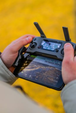
Drones have changed the way we map land, inspect buildings, and survey construction sites. What once took days can now take hours. But here’s the secret most people miss: the drone is only half the story. The real magic happens before takeoff. That’s where mission planning software comes in. These tools help you design flight paths, automate data capture, and turn raw images into usable maps and models.
TLDR: Drone mission planning software helps you fly smarter, safer, and faster. The right tool can automate flight paths, improve data accuracy, and save hours of fieldwork. In this guide, we explore seven popular tools for mapping, inspection, and surveying. We also compare them so you can choose the best one for your needs.
Let’s break it down in a simple and fun way.
Why Mission Planning Software Matters
All Heading
Imagine mowing a lawn. Would you rather walk randomly or follow neat lines? Neat lines win every time. Drone mission planning works the same way. It ensures:
- Even coverage of your area.
- Consistent image overlap for accurate maps.
- Safer flights with fewer surprises.
- Automated routes to reduce human error.
Now let’s explore the tools that make this happen.
1. DJI Pilot 2
If you fly DJI enterprise drones, this tool is likely already in your toolkit. DJI Pilot 2 is designed for professional missions like mapping and inspections.
What makes it great:
- Seamless integration with DJI enterprise drones.
- Waypoints, mapping grids, and corridor missions.
- Real-time mission preview.
- Cloud-based project management.
It’s clean. It’s easy. It just works. For DJI Matrice or Mavic Enterprise users, this is often the default choice.
2. DroneDeploy
DroneDeploy is one of the most popular mapping platforms in the world. It works with many drone brands. It’s cloud-based. And it focuses heavily on construction, agriculture, and energy industries.
Why people love it:
- Automatic flight planning.
- Fast cloud processing.
- 2D maps and 3D models.
- Easy team collaboration.
It feels simple. But under the hood, it’s powerful. You can measure stockpiles. Track construction progress. Even inspect roofs safely.
One big plus? You don’t need deep technical skills to get started.
3. Pix4Dcapture (with PIX4Dcloud or PIX4Dmapper)
Pix4D is a big name in photogrammetry. Pix4Dcapture handles flight planning. Then PIX4Dcloud or PIX4Dmapper processes the images.
Best features:
- Precise grid and double-grid missions.
- Corridor mapping for roads and railways.
- Strong surveying accuracy.
- Advanced processing options.
Surveyors love Pix4D. It gives you deep control over outputs. Ground control points? No problem. High-accuracy deliverables? Yes.
It may feel more technical than other tools. But the control is worth it.
4. UgCS (Universal Ground Control Software)
UgCS is built for professionals who want serious customization. It supports many drone brands. Including DJI, Ardupilot, and PX4 systems.
What stands out:
- 3D mission planning.
- Terrain-following flights.
- Complex vertical inspections.
- Desktop-based planning.
This is not just tap-and-fly. It’s detailed mission engineering.
If you inspect towers, power lines, or steep terrain, UgCS is extremely useful.
Image not found in postmeta5. Litchi
Litchi is popular with hobbyists and professionals alike. It’s especially known in the DJI community.
Why it’s interesting:
- Easy waypoint missions.
- Orbit and panorama modes.
- Affordable pricing.
- Mission Hub for desktop planning.
While it’s not as specialized for industrial surveying as others, it’s flexible and user-friendly.
For basic mapping and repeatable inspection routes, it’s a great entry-level solution.
6. Hammer Missions
Hammer Missions focuses on automation. It supports DJI drones and simplifies complex mapping setups.
Key benefits:
- Automated grid missions.
- Consistent overlap settings.
- No subscription required.
- Clean, simple interface.
It’s lightweight. Straightforward. And reliable.
If you want no-frills mission planning without cloud dependency, this is worth exploring.
7. QGroundControl
QGroundControl is an open-source option. It works great with PX4 and Ardupilot drones.
Why choose open-source?
- Free to use.
- Customizable.
- Strong community support.
- Works on multiple platforms.
It’s not as polished visually. But it’s very capable. And for research teams or advanced users, flexibility matters more than looks.
Quick Comparison Chart
| Software | Best For | Ease of Use | Drone Compatibility | Cloud Processing |
|---|---|---|---|---|
| DJI Pilot 2 | DJI enterprise users | Very Easy | DJI only | Yes |
| DroneDeploy | Construction and agriculture | Easy | Multiple brands | Yes |
| Pix4D | High-accuracy surveying | Moderate | Multiple brands | Yes |
| UgCS | Complex inspections | Advanced | Multiple brands | Optional |
| Litchi | Entry-level missions | Very Easy | DJI mainly | No |
| Hammer Missions | Simple grid mapping | Easy | DJI | No |
| QGroundControl | Open-source projects | Moderate | PX4 and Ardupilot | No |
How to Choose the Right One
Don’t overthink it. Start with three simple questions:
- What drone are you flying?
- How accurate do your results need to be?
- Do you prefer cloud or desktop processing?
If you fly DJI enterprise drones and want smooth integration, DJI Pilot 2 is perfect.
If you want powerful mapping with easy collaboration, DroneDeploy is a strong choice.
If you care about survey-grade outputs, Pix4D may be your best friend.
If you need advanced inspection routes in 3D environments, look at UgCS.
And if budget matters, open-source QGroundControl is very appealing.
Mapping vs Inspection vs Surveying
These terms get mixed up. But they are not the same.
Mapping focuses on creating large-scale 2D maps or 3D models. Think farms. Construction sites. Quarries.
Inspection zooms in. It checks details. Like cracks in towers or damage on roofs.
Surveying demands high accuracy. It often uses ground control points. And sometimes RTK or PPK corrections.
Image not found in postmetaEach mission type may need slightly different features. That’s why software choice matters.
Final Thoughts
Drone mission planning software is like a smart assistant. It tells your drone where to go. How high to fly. When to take photos. And how to cover every inch efficiently.
The drone industry keeps growing. Tools keep improving. Automation is becoming standard.
The best part? You do not need to be an engineer to use these platforms. Many are designed with simple interfaces and guided workflows.
Start small. Test different options. Learn what fits your work style.
Because at the end of the day, great drone data doesn’t happen by accident. It happens by planning.
Fly smart. Plan smarter.


Recent Comments